blah blah blah
Lost Pond
Length: 1.0 mile out-and-backDifficulty (click for info): Beginner
Elevation Gain: 50 feet
Rating (click for info): 5/10
Elevation: 2060'
Driving Directions:
Trailhead and parking area are on Rt. 16, in Pinkhams Grant, NH, 11.8 miles north of its northern junction with Rt. 302 in Conway and 10.6 miles south of its eastern junction with Rt. 2 in Gorham. There is a very large parking area on the west side of the road at the AMC Pinkham Notch Visitor Center.
About the Hike:
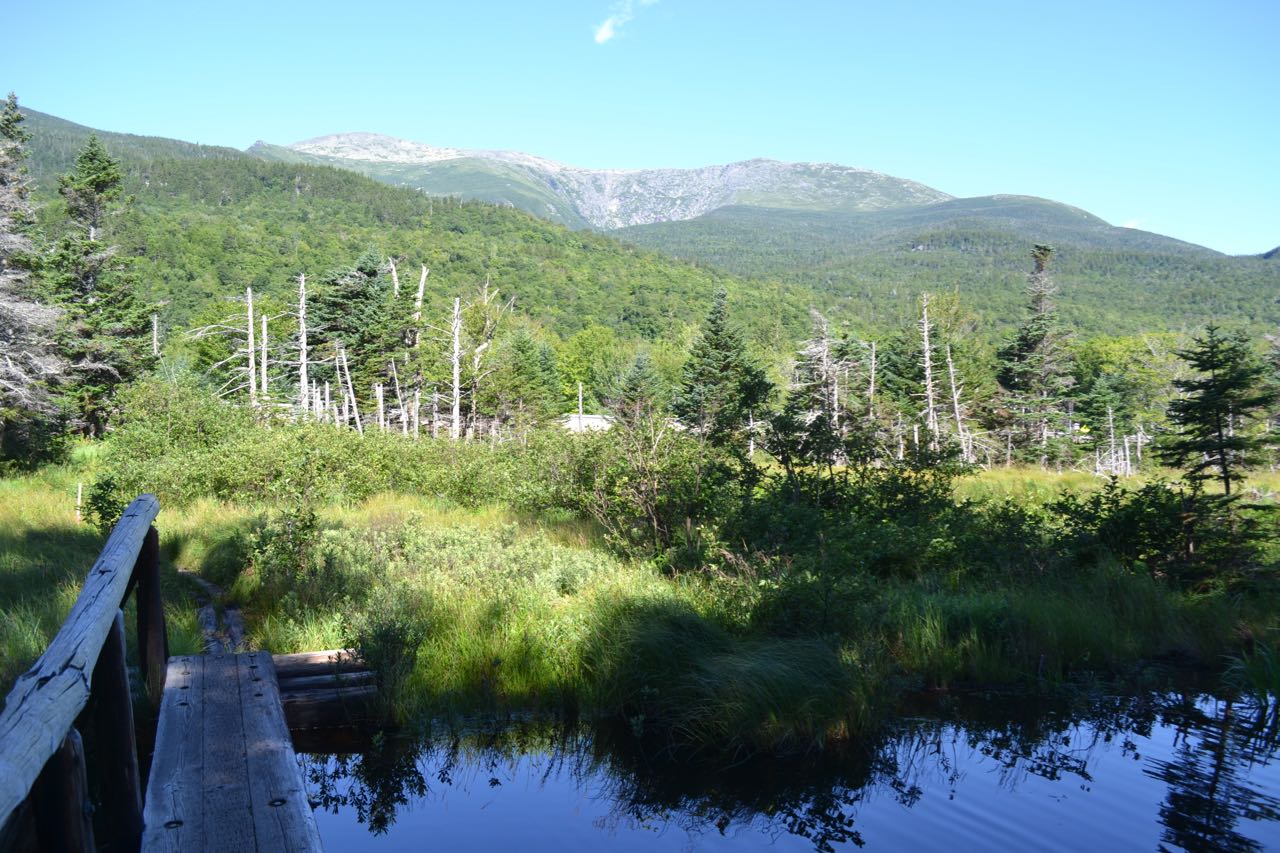
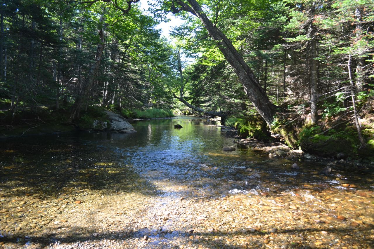
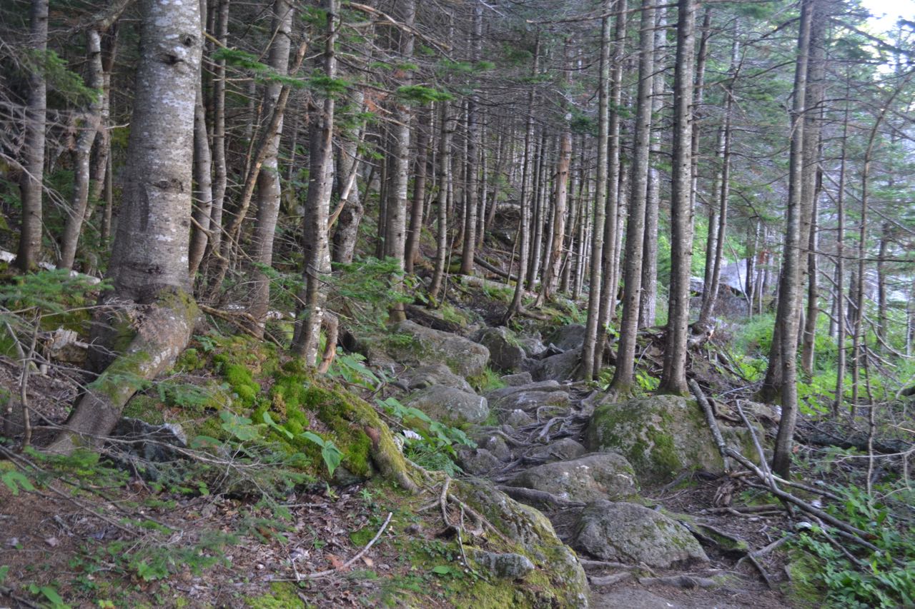
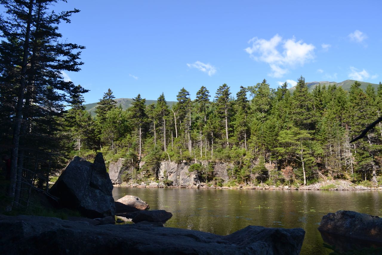
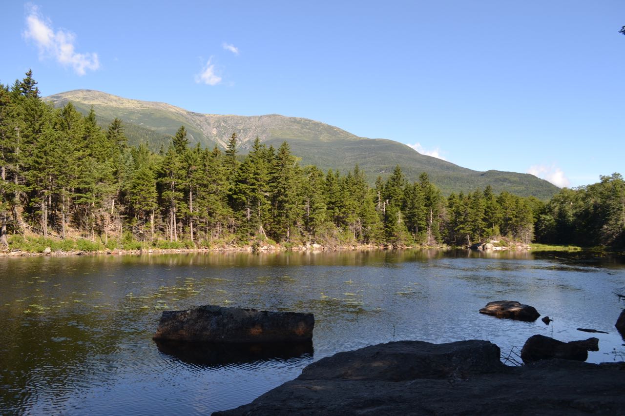
The short walk to Lost Pond is a rewarding trip if you're in the Pinkham Notch area. From the shoreline rocks, there is a picturesque view of Mt. Washington over the lilly pad-filled water. From the Pinkham Notch visitor center, cross the road to the sign for Lost Pond Trail and follow the boardwalk across a marsh. On the other side, turn right as Square Ledge Trail continues ahead. In 0.2 miles, the trail joins the Ellis River just after its formation at the convergence of the Cutler and New Rivers. The trail follows the river for a short way, then pulls away and climbs steadily on a rocky pathway for 0.2 miles to reach the northern shore of the pond. Continue on the trail to several boulder-filled viewpoints over the water. Mt. Washington rises over the trees to the right. The summit is not visible, but there is a great view into Huntington Ravine and Nelson Crag above.
Printable directions page